Back مقاطعة ليفينغستون (كنتاكي) Arabic Livingston County, Kentucky BAR Ливингстън (окръг, Кентъки) Bulgarian লিভিংটন কাউন্টি, কেন্টাকি BPY Livingston Gông (Kentucky) CDO Ливингстон (гуо, Кентукки) CE Livingston County (kondado sa Tinipong Bansa, Kentucky) CEB Livingston County, Kentucky Welsh Livingston County (Kentucky) German Κομητεία Λίβινγκστον (Κεντάκι) Greek
Livingston County | |
|---|---|
 Livingston County Courthouse in Smithland | |
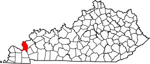
 Location within the U.S. state of Kentucky | |
 Kentucky's location within the U.S. | |
| Coordinates: 37°13′N 88°21′W / 37.21°N 88.35°W | |
| Country | |
| State | |
| Founded | 1798 |
| Named for | Robert R. Livingston |
| Seat | Smithland |
| Largest community | Ledbetter |
| Area | |
| • Total | 342 sq mi (890 km2) |
| • Land | 313 sq mi (810 km2) |
| • Water | 29 sq mi (80 km2) 8.5% |
| Population (2020) | |
| • Total | 8,888 |
| • Estimate (2023) | 8,892 |
| • Density | 26/sq mi (10/km2) |
| Time zone | UTC−6 (Central) |
| • Summer (DST) | UTC−5 (CDT) |
| Congressional district | 1st |
| Website | livingstoncountyky |
Livingston County is a county located in the U.S. state of Kentucky. As of the 2020 census, the population was 8,888.[1] Its county seat is Smithland and its largest community is Ledbetter.[2] The county was established in 1798 from land taken from Christian County and is named for Robert R. Livingston, a member of the Committee of Five that drafted the U.S. Declaration of Independence.[3] The county was strongly pro-Confederate during the American Civil War and many men volunteered for the Confederate Army.[4][5] Livingston County is part of the Paducah, KY-IL Metropolitan Statistical Area. It is a prohibition or dry county with the exception of Grand Rivers which voted to allow alcohol sales in 2016.[6]
- ^ "Census - Geography Profile: Livingston County, Kentucky". United States Census Bureau. Retrieved December 30, 2022.
- ^ "Find a County". National Association of Counties. Retrieved June 7, 2011.
- ^ Collins, Lewis (1877). History of Kentucky. p. 478. ISBN 9780722249208.
- ^ Collins, Lewis (1882). Collins' Historical Sketches of Kentucky: History of Kentucky, Volume 2. Collins & Company. p. 26.
- ^ The Register of the Kentucky State Historical Society, Volume 1. Kentucky State Historical Society. 1903. pp. 36.
- ^ Fuller, Leanne. "Voters decide to allow alcohol sales in Grand Rivers". WPSD Local 6. Retrieved November 15, 2021.